How GPS Fleet Tracking and Route Optimization Work Together for Canadian Delivery Fleets
Drafted with AI assistance, edited and fact-checked by Sean Flannery. See our editorial policy.
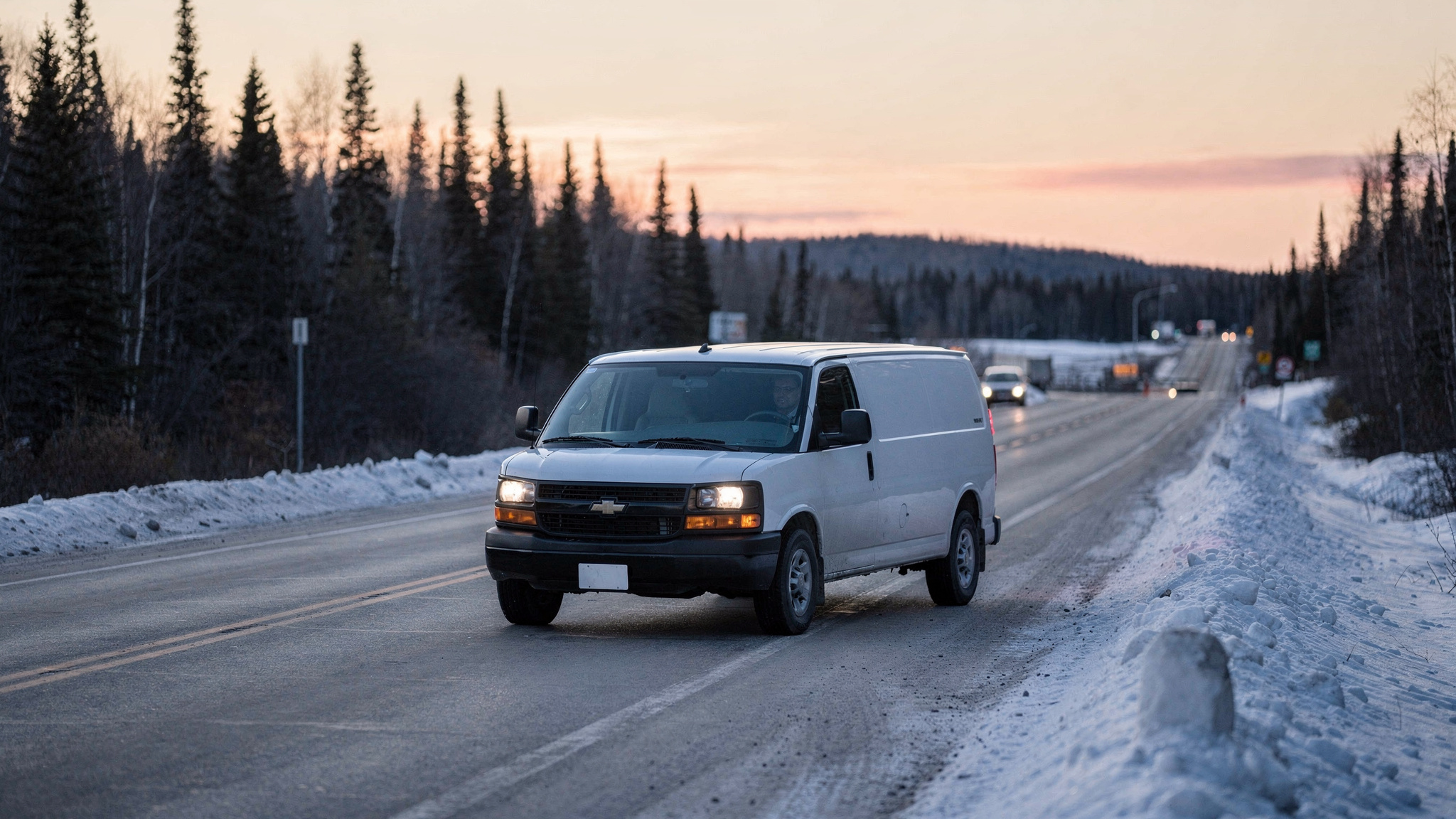
GPS fleet tracking route optimization combines two jobs in one platform: route optimization plans an efficient order of stops before drivers leave, and GPS tracking shows where every vehicle is once they do. For Canadian fleets facing winter roads, long distances and regional diesel price rises, the pairing lets dispatchers adjust plans during the day.
A route built before sunrise is a best guess. By mid-afternoon, a snow squall on a northern highway, an extra pickup downtown or a customer asking for a later drop can reshape the day.
Tracking lets the plan keep up. Dispatch sees the change as it happens, and the remaining stops can be re-sequenced while drivers are still on the road.
GPS fleet tracking and route optimization work best as one connected loop
Route planning and vehicle tracking are often treated as two separate tools. They do their best work as one loop, where each half feeds the other.
The plan comes first. Route optimization takes the day's stops, delivery windows, vehicle types and driver availability, then works out an efficient order for every vehicle.
Locate2u's route optimization builds each run around those constraints, so a plan starts from the real limits of the day, not a bare list of addresses.
Then the plan meets the road. Once vehicles leave the yard, GPS positions show whether each one is ahead, on time or running behind.
That live picture makes adjustment possible. A dispatcher who spots a delay early can move the next stop to another vehicle or send the customer a revised arrival time.
Locate2u customer Patient Transport Services Queensland (PTSQ) runs its non-emergency medical transport fleet on exactly this loop, as its story below shows.
At the end of the shift, the loop closes. Planned routes and tracked routes sit side by side, and the gaps between them show which assumptions to update for tomorrow.
Maybe a busy site takes longer to unload than the plan allowed. Maybe a stretch of highway runs slower once the snow arrives. Each correction makes the next plan more realistic.
For more on the planning half by itself, see this guide to how route optimization works and why it's essential.
Regional diesel price rises make every planned kilometre worth reviewing
Every extra kilometre on a route is paid for in fuel, and diesel costs climbed sharply over the past year.
According to Statistics Canada's StatsCAN Plus analysis, diesel prices at the producer level rose between 35.4% and 76.1%, depending on the region, from May 2025 to May 2026, as measured by the Industrial Product Price Index.
The regional spread is the useful detail. A fleet with depots in more than one province has good reason to review routes depot by depot, starting where the rise was steepest, instead of treating fuel as one national number.
Outside delivery rates rose as well. The same Statistics Canada analysis found that couriers charged 16.9% more in April 2026 than a year earlier, and local messengers and local delivery charged 5.4% more.
For fleets that hand overflow or distant stops to an outside service, that changes the sums. Moving more of those stops onto well-planned in-house routes is worth recalculating at current rates.
A GPS fleet tracking route optimization setup supplies the two numbers any review needs: the kilometres each route was planned to cover, and the kilometres it actually covered.
The gap between them is where to look first.
Extra kilometres tend to come from process gaps. A late stop gets added to the end of a route instead of slotted into the right place. A return leg heads back to the depot when tomorrow's first stop sits in the other direction.
Fixing those gaps is planning work, and the benefit repeats. Every kilometre removed from a regular route stays removed each time that route runs.
The saving reaches beyond fuel. Transport Canada's 2025 annual report found that road vehicles accounted for 79% (120 Mt) of Canada's transportation greenhouse gas emissions, so shorter regular routes cut emissions as well as fuel costs every time they run.
Live tracking links help set clear delivery expectations for Canadian customers
More Canadian shopping ends at a front door. Statistics Canada reported in The Daily that e-commerce sales grew 9.0% in 2024, as the trend toward digital shopping continued.
For fleets delivering to homes, more online orders means more stops where the recipient needs to be in. A missed first attempt puts the stop back on a later route, so a clear arrival time helps the first visit count.
A live tracking link answers that without a phone call. The recipient opens it and follows the vehicle's approach, using the same GPS position the dispatch team sees.
Locate2u's real-time tracking shares a live link with each customer, so they can plan their day around the delivery.
Fewer calls about arrival times also frees dispatch to focus on the plan itself.
Tracking links build the most confidence when the arrival time behind them stays accurate. That is where the connected loop pays off: when a route is re-sequenced around a delay, the customer sees the updated time, not the one set before sunrise.
Language is part of the experience too. In Québec, New Brunswick and other bilingual communities, a tracking link in the recipient's own language, English or French, makes the arrival time easier to act on.
Winter roads and northern routes reward plans that can adapt during the day
Canada's delivery geography runs long. In Transport Canada's Transportation in Canada 2023 report, Northern and Remote routes represent 15.5 per cent of the National Highway System.
On those corridors, one closure or whiteout can change the whole afternoon. A plan that adapts during the day keeps the rest of the route moving.
Weather pressure is not limited to winter. Transport Canada's 2025 annual report notes a severe wildfire season across Western Canada.
For depots in the West, that is a reason to keep pre-planned detour routes for key corridors and to check road closures before routes are released each morning of fire season. Affected stops can then be re-sequenced before drivers set out.
Some routes exist for only part of the year. The Government of Ontario notes that Far North winter roads, built over land and frozen lakes and rivers, are used from around mid-January until spring thaw.
Fleets serving those communities plan around that season, and tracked history from previous seasons shows how travel times actually ran.
In practice, an adaptive plan works like this. A slowdown shows on the tracking map as vehicles on one stretch of highway stop moving.
The dispatcher moves the affected stops to a later run, another vehicle or the next day. Those customers receive a revised arrival time.
Good dispatch planning makes those changes quick, so a disrupted morning does not have to become a disrupted day.
Give winter its own planning assumptions as well. Stops take longer when a loading area needs clearing, and last winter's tracked times show how much longer on your own routes.

Fleet-wide visibility helps plan warm-ups on the coldest mornings
On the coldest mornings, the working day starts well before the first stop. Vehicles need to warm up and windows need clearing before anyone leaves the yard.
Knowing where every vehicle spent the night makes that time easier to plan. A live fleet view shows which vehicles are at the depot, at a satellite yard or parked near a driver's home.
That picture helps shape the morning:
- Stagger departure times so vehicles warm up and load in turn, not all at once in a crowded yard.
- Assign the first stops to the vehicles parked closest to them, so the early kilometres are working kilometres.
- Plan block-heater access where vehicles park overnight. Government of Canada fuel-efficiency guidance credits block heaters with better overall fuel economy in deep cold, so a plugged-in vehicle starts the day using less fuel.
- Keep a quick reassignment ready, so a vehicle that needs extra time to start can hand its first stops to another.
Once routes are moving, the same view shows whether departures ran on schedule. A week of cold-morning start times gives dispatch a realistic assumption for the rest of the season.
If your tracking hardware reports ignition or idle time, add it to the morning review. Ask any platform whether it records these before building a process around them.
Owner-operators and small fleets can plan with the same tools as larger dispatch teams
Transport Canada counts 146,248 trucking businesses as of December 2023, and 92,168 of them had no employees.
In a business with no employees, the person driving is often the person planning, quoting and answering customers too.
That makes planning time precious. Route optimization turns an evening of sorting addresses into a quick review of a suggested order, and a tracking link tells the customer when to expect the delivery while the owner is still driving.
A sensible starting point is the two features used every day: automatic stop order and a customer tracking link. Tools built for larger dispatch teams can be added as the fleet grows.
Compare the plans on Locate2u's pricing page against the number of people who will plan and drive, and choose the level that fits today's fleet.
A medical transport fleet shows routing and live tracking working as one
Patient Transport Services Queensland, known as PTSQ, provides non-emergency medical transport for patients travelling to and from hospitals, specialist appointments and aged care facilities across Queensland, Australia.
Its story, told on its case study page, shows routing and tracking working together on routes where timing matters most.
The work is demanding. PTSQ manages a fleet across a vast geographic area, with vehicles ranging from wheelchair-accessible configurations to stretcher transport, and each vehicle can handle multiple pickups and drop-offs in a day.
Patients have fixed appointment times, and as its case study page explains, a missed appointment can mean weeks of delay in a patient's treatment plan.
Planning routes manually took the scheduling team significant time, balancing appointment times with driver availability, vehicle types and travel distances. Last-minute bookings and cancellations meant reworking the day.
PTSQ adopted Locate2u to bring route optimization and real-time fleet management together. According to its case study page, the routing engine accounts for patient appointment times, vehicle types, driver availability and geographic constraints, producing schedules that make full use of the fleet while getting every patient to their appointment on time.
Tracking completes the loop. The dispatch team works from a live dashboard showing every vehicle.
When a transport runs behind because of traffic or a longer patient pickup, the team sees it straight away and acts, by reassigning the next pickup to another vehicle or giving the receiving facility a revised arrival time.
Canadian fleets with fixed windows and long distances between stops (rural health services, scheduled trade deliveries, regional wholesale runs) can apply the same pattern.
Picture a rural health transport service running between northern Ontario communities and a regional hospital. When a winter squall slows one vehicle, the next pickup moves to another and the hospital receives a revised arrival time before anyone has to ask.
A practical checklist for testing tracking and routing on your own routes
The clearest way to judge a GPS fleet tracking route optimization platform is on a week of your own routes.
Record a baseline first: kilometres per route, stops per shift, start and finish times, and fuel purchased. Then work through these tests, agreeing each example target with the team before the week starts.
| What to test | How to test it | What to look for | Example target to agree with the team |
|---|---|---|---|
| A normal day's plan | Load a typical day's stops, delivery windows and vehicle types | Windows and vehicle limits respected, with a sensible order of stops | Every stop sits inside its window on the first plan |
| Remote corridor coverage | Fit a tracking device on your longest northern or rural run | How often positions reach dispatch where coverage is patchy | Positions arrive often enough to follow the whole run on the map |
| Mid-day changes | Add an urgent stop and cancel another while routes are running | The updated route reaches the driver quickly and other stops stay on time | The new route reaches the driver before the current stop is finished |
| Customer tracking links | Send links to test recipients in English and French | Clear wording in both languages, set per customer or service area | Each recipient sees their own language with no manual change |
| Planned and actual kilometres | Export planned and GPS-tracked distance for each route | A report you can compare against your baseline, route by route | Any route that runs over plan on most days of the week goes to the top of the review list |
| Vehicle utilization history | Export trip history by vehicle | Kilometres, hours in use and stops per vehicle for replacement planning | Every vehicle's kilometres and hours appear in one export |
Include your hardest conditions in the test. A cold start, a remote run and a day full of late additions will show more than a quiet Tuesday.
When the week ends, compare the results with your baseline, route by route. The routes where planned and actual kilometres differ most are the best place to start refining the plan.
Frequently asked questions
Does GPS fleet tracking work on northern and remote Canadian routes?
The National Research Council Canada describes GPS as a satellite-based radio-navigation system that provides precise time and position information. How often that position reaches your dispatch team depends on the tracking device and its connection, so test a device on your most remote corridors before rolling it out fleet-wide.
Can customer tracking updates be sent in both English and French?
For fleets serving bilingual regions, ask any platform to show you its customer notification and tracking-link wording in both official languages before you commit. Check that the language can be set per customer or per service area, not only fleet-wide.
Does a routing platform handle hours-of-service requirements?
Route plans and shift lengths should always sit within the hours-of-service rules that apply to your drivers. Check the current requirements with Transport Canada and your provincial ministry of transportation, and confirm how any platform records driver shifts before relying on it.
Can GPS tracking data help with vehicle replacement planning?
Yes, where the platform lets you export trip and utilization history. Kilometres driven, hours in use and stops per vehicle give a clear picture of which vehicles carry the most work, which is useful input when deciding what to replace, reassign or right-size.
GPS fleet tracking and route optimization do the most for Canadian fleets when they run as one loop: plan the stops, follow the vehicles, adjust during the day and feed what happened into tomorrow's plan. With diesel costs varying by region and winter reshaping roads within a single shift, that routine keeps deliveries on time and customers informed.
To see how planning and live tracking fit together in one place, explore Locate2u's fleet management platform and run it against the checklist above on your own routes.